
SÚRIA: GEOTOUR IN LES GUIXERES
GEOLOGICAL AND HERITAGE TRAIL

Interest:
Geology, history, medieval heritage, industrial heritage, hiking
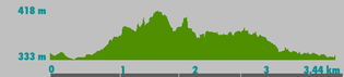
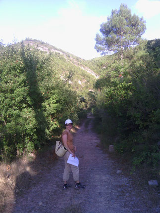
Approximate length: 2h 30min - 3h
Difficulty: gentle/moderate
Languages: Catalan, Spanish, English, French
Material for the
attendees:
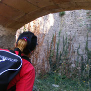
Guide explanations are complemented with
augmented reality new technologies and applications for mobile devices.

REMEMBER!
- No walking off the beaten track.
- Respect geological heritage.
- No damage outcrops.
- Do not collect rock samples unless the guide indicates to do it.
RECOMMENDATIONS:
Water, food, hat, sunscreen, appropriate clothing, confortable footwear to walk in the forest and medication if need it (allergies, etc.).
SÚRIA: LES GUIXERES & ICT
GYMKHANA WITH NEW TECHNOLOGIES
Description:
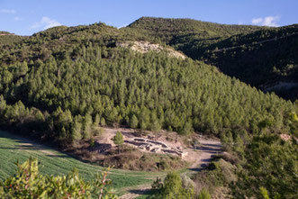
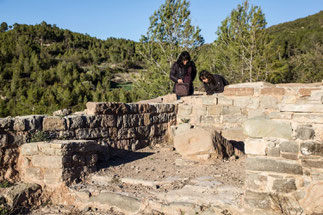
Leisure activity in nature that includes
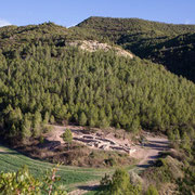
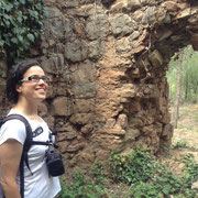
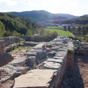
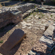
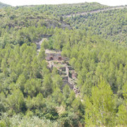
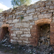
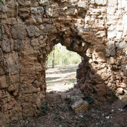
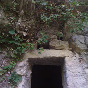
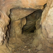
the whole itinerary of the gypsum kilns at Les Guixeres area, plus El Trali Spring and the remains of: El Puig de Sant Pere Tower, El Puig de Sant Pere Church and Vilella Vella Country House.
Tour guide explanations are combined with team activities while using augmented reality, QR codes and apps to understand geological phenomena in the area, its medieval origins, and the
significance that gypsum production had in Suria.
It's a kind of activity suitable for groups, companies, individuals and schools (over 12 years old).
Interest:
Geology, history, medieval heritage,
industrial heriatge, hiking, new technologies
Approximate duration: 3h 30 min
(Tour + gymkhana with new
technologies)
Languages: Catalan,
Spanish, English or French
Dificultad: moderate
Material for the attendees:
QR codes and artwork. Recommended to
bring a mobile device for each team.

REMEMBER!
- No walking off the beaten track.
- Respect geological heritage.
- No damage outcrops.
- Do not collect rock samples unless the guide indicates to do it.
RECOMMENDATIONS:
Water, food, hat, sunscreen, appropriate clothing, confortable footwear to walk in the forest and medication if need it (allergies, etc.).
RATES
|
GEOTOUR LES GUIXERES |
LES GUIXERES & ICT
(WITH NEW TECHNOLOGIES) |
|||
| Catalan / Spanish | English / French |
Catalan / Spanish |
English / French | |
| Adults | 7,50€ | 9,50€ |
10,50€ |
12,50€ |
|
Seniors
Students
Unemployed |
5,50€ |
7,50€ |
8,50€ |
10,50€ |
|
Children (8-12 years old) |
4,50€ | 6,50€ |
7,50€ |
9,50€ |
|
Under
8 years old |
Free |
Free |
Free |
Free |
| Groups |
Contact |
Contact |
Contact |
Contact |
(*) Prices are per person and include 21% VAT.
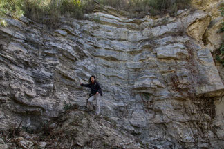
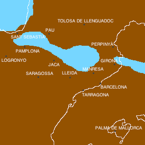
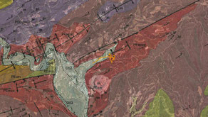
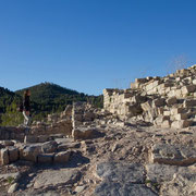
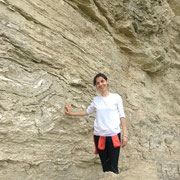
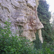
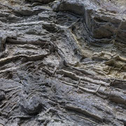
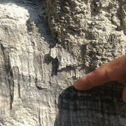
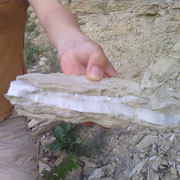
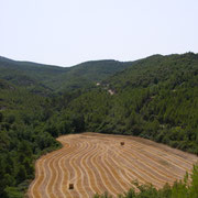
Geological relevance of Súria
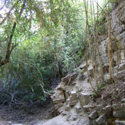
This town, still engaged in mining potash (discovered in 1912), is located in an area of geological folds (rock deformation) and thrust of the Potassic Catalan Basin. In Suria materials from Paleogene have been settled (about 41-34 million years ago), with salts of about 37 million years ago, and processes of river erosion and tectonic movements that characterize the well known Migmón anticline and Tordell fault, a variety of sedimentary rocks (gypsum, limestone, clays, sandstones and conglomerates), sinkholes and river terraces. In addition, Súria has some mine shafts whose location allows to understand very well the relationship between geological structure and the status of their mining operations.
Recovery of a Local Heritage: Les Guixeres Retirees Volunteer Group
(In Catalan)

PHOTO GALLERY


CONTACT:
Ph. +34-654166863
WhatsApp: +353-899727050
info@tourinnonvation.com